
A slow journey from Baiona to Donostia, across fishing harbours, imperial resorts, mountain paths and a border that does not end a culture
On a political map, this journey begins in France and ends in Spain. That is correct, but culturally incomplete.
In the geography of the Basque Country, the route travels from Iparralde, the northern Basque territories, to Hegoalde, the southern side. The Bidasoa marks a state border, yet many things continue across it: Euskara, pelota courts, fishing traditions, whitewashed farmhouses, maritime memories and a way of gathering around food.
Our Via Littorale follows that continuity for approximately 67.7 kilometres, divided into five deliberately measured stages. This is not the fastest way from Bayonne to San Sebastián. It is a route designed to leave time for markets, ports, old quarters, landscapes and conversations.
The differences between the two sides of the border are not erased. Architecture changes, as do languages, menus and the rhythm of public life. The advantage of travelling slowly is precisely that these changes can be noticed without losing sight of the shared cultural ground beneath them.
| Stage | Distance | Ascent | Descent |
|---|---|---|---|
| Bayonne – Bidart | 15.9 km | 239 m | 199 m |
| Bidart – Saint-Jean-de-Luz | 13.9 km | 210 m | 267 m |
| Saint-Jean-de-Luz – Hondarribia | 15.2 km | 267 m | 257 m |
| Hondarribia – Pasai Donibane | 14.7 km | 643 m | 653 m |
| Pasai Donibane – Donostia | 8.0 km | 434 m | 432 m |
Day 1 — Bayonne to Bidart
Rivers, chocolate and the invention of the seaside
The journey begins in Bayonne —Baiona in Basque— at the meeting of the Nive and the Adour.
Long before the modern city, a Roman stronghold known as Lapurdum occupied this strategic position. Its name survives in Lapurdi, the Basque province through which the first part of the route travels. Towers, ramparts and the narrow streets surrounding Sainte-Marie Cathedral still reveal a city shaped by defence, trade and the river.
Yet one of Bayonne’s most distinctive traditions arrived with people seeking refuge. During the seventeenth century, Portuguese Jewish families fleeing the Inquisition settled in the Saint-Esprit district. They brought knowledge of cocoa and chocolate making, helping Bayonne become one of Europe’s historic chocolate cities.
Beginning the route with a cup of thick hot chocolate is therefore more than an indulgence. It recalls migration, religious persecution, port trade and the way displaced communities can transform the culture of the place that receives them.
From Bayonne, the route moves towards the Atlantic through Anglet and its succession of beaches. The river city gradually opens into a landscape of dunes, salt air and exposed coastline.
Biarritz introduces a different historical world. It was once a modest fishing and whaling settlement, but its fortunes changed after Empress Eugénie, who knew the coast from childhood, brought Napoleon III here. The imperial residence built for her became the Hôtel du Palais, and Biarritz was transformed into one of nineteenth-century Europe’s fashionable resorts.
This contrast is important: within a few kilometres, the traveller moves from a commercial and fortified city to a coastline reimagined for aristocratic leisure.
Beyond Biarritz, the atmosphere becomes more intimate. Bidart —Bidarte— retains the structure of a Labourdine village: church, town hall and fronton facing one another. The fronton is not simply a sports facility. It is one of the traditional stages of community life, where pelota, festivals and village identity meet.
The stage ends near Erretegia, where the cliffs and Atlantic horizon announce the landscape that will accompany the following days.
Cultural pauses: Bayonne’s old town and market, Sainte-Marie Cathedral, the chocolate houses of Bayonne, the Biarritz waterfront and Bidart’s central fronton.
At the table: Bayonne ham, hot chocolate, talo filled with ham or sheep’s cheese, and the first seafood of the journey.
Day 2 — Bidart to Saint-Jean-de-Luz
Village frontons and the memory of the whale
The second stage is shorter, allowing the route to follow the coast without reducing it to a succession of viewpoints.
South of Bidart, the landscape alternates between cliffs, beaches and small settlements. Basque houses traditionally turn their strongest side towards the Atlantic weather, while their painted timber façades look towards the sun, the street or the family courtyard.
Guéthary —Getaria in Basque— is one of the stage’s essential pauses. Its tiny port is a dry harbour: boats were traditionally lifted from the water and hauled up the slipway rather than left behind a protective breakwater.
It is a small place with a much larger maritime history. Fishing and whaling sustained generations of local families. Basque crews sailed progressively farther into the North Atlantic, eventually reaching Newfoundland and Labrador in pursuit of cod and whales.
The route therefore follows a coast that was never isolated. Its small harbours were connected to distant oceans long before tourism arrived.
The final approach to Saint-Jean-de-Luz, or Donibane Lohizune, leads towards the mouth of the Nivelle. The bay appears calm today because of its protective sea walls, but the history of the town was shaped by storms, shifting sands, fishing, privateering and ocean voyages.
Saint-Jean-de-Luz is usually introduced through the marriage of Louis XIV and María Teresa of Spain in 1660. The ceremony, held in the Church of Saint-Jean-Baptiste, sealed the peace agreed in the Treaty of the Pyrenees.
But the royal wedding should not obscure the people who made the town wealthy enough to receive a court. Shipowners, fishermen, corsairs, rope-makers and crews involved in cod fishing and whaling built the local prosperity. The grand houses surrounding the port are not merely royal scenery; they are monuments to maritime commerce.
This is why the slow stage works. Arriving early leaves time to enter the church, walk around the harbour and distinguish the history of a working port from the polished image of a seaside resort.
Cultural pauses: Bidart’s village centre, the dry port of Guéthary, Sainte-Barbe above Saint-Jean-de-Luz, the fishing harbour, Maison Louis XIV and the Church of Saint-Jean-Baptiste.
At the table: Chipirons à la luzienne, grilled fish, ttoro fish stew and gâteau basque. Dinner beside the harbour provides the natural conclusion to a day devoted to the sea.
Day 3 — Saint-Jean-de-Luz to Hondarribia
A royal frontier and a border crossed by boat
The day begins by crossing towards Ciboure —Ziburu— on the opposite bank of the Nivelle.
Although joined to Saint-Jean-de-Luz by the harbour, Ciboure has its own personality. Its waterfront houses reflect the wealth of shipowners and fishing families, while the town is also remembered as the birthplace of composer Maurice Ravel. Born here in 1875, Ravel belonged through his mother to a local family with strong maritime connections.
From Ciboure and Socoa, the route enters the Corniche Basque, where the Pyrenees reach the Atlantic in folded cliffs, coves and tilted layers of rock.
The vegetation tells its own story of exposure. Atlantic heath, grazed meadows, hedges and wind-shaped copses coexist with oak-and-ash woodland and alder in wetter folds of the land. Sarsaparilla forms dense natural screens that allow deciduous trees to survive surprisingly close to the ocean.
Near Hendaye lies the Domaine d’Abbadia, associated with Antoine d’Abbadie. Born in 1810 to a Basque father and Irish mother, he became an explorer, geographer, astronomer and defender of the Basque language. His neo-Gothic château-observatory is one of the more unexpected cultural landmarks of the coast: part scientific station, part family residence and part expression of a complex Basque and European identity.
The stage eventually reaches Hendaia and Txingudi Bay. Hondarribia is already visible across the water.
Crossing the bay by passenger boat is one of the defining moments of the route. Passports, administrations and road signs change, but the surrounding mountains, fishing boats and Basque place names remain.
The crossing should not be treated merely as convenient transport. It allows the traveller to experience the border from the water and to understand the Bidasoa as both division and meeting place.
Hondarribia rises above the harbour behind its walls. Its strategic position at the mouth of the river explains the bastions, gates and Castle of Charles V. Below the fortified town, the brightly painted houses of the Marina belong to a different history: that of fishermen, harbour workers and family taverns.
The day ends between these two Hondarribias —the military town above and the maritime neighbourhood below.
Cultural pauses: Ciboure’s waterfront, Socoa, the Corniche landscape, Abbadia, the Hendaye–Hondarribia boat and Hondarribia’s walled quarter.
At the table: Begin in the Marina with a small pintxo route rather than a single formal meal. Local fish and shellfish pair naturally with txakoli, the lightly acidic coastal wine made principally from grapes such as Hondarrabi Zuri.
Day 4 — Hondarribia to Pasai Donibane
Jaizkibel, where the mountain enters the sea
At only 14.7 kilometres, this might appear to be another gentle stage. The elevation profile tells a different story: more than 640 metres of ascent and descent make it the most physically demanding day of the route.
From Hondarribia, the path climbs towards Jaizkibel. Vineyards on its lower slopes produce txakoli, but the cultivated land soon gives way to a broader mountain landscape of pasture, heath, fern and exposed rock.
Jaizkibel should not be hurried. It is simultaneously a natural balcony, a defensive frontier and a prehistoric cultural landscape.
Long before medieval kingdoms disputed the Bidasoa, communities were already burying their dead on these heights. Dolmens, burial mounds and cromlechs form part of a funerary landscape used from around 4000 BCE. The mountain was therefore meaningful thousands of years before the modern border existed.
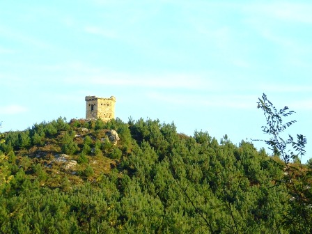
Later generations added lookout posts, defensive towers and military roads. From the higher ground, the strategic importance of the coast becomes clear: Txingudi behind, the open Bay of Biscay to one side and the narrow entrance to Pasaia ahead.
The descent eventually leads towards Lezo and Pasai Donibane, a long, narrow maritime settlement protected between Jaizkibel and Ulia.
Pasai Donibane seems compressed between mountain and water. Its principal street passes beneath houses and through stone archways before opening suddenly onto Santiago Square and the harbour. Victor Hugo stayed here in 1843 and wrote about the town, but its deeper identity belongs to sailors, pilots, shipbuilders and fishing families.
The remains of Santa Isabel Castle recall the need to defend this narrow harbour entrance from enemy vessels and pirates. The same sheltered inlet that made Pasaia strategically valuable also helped it become one of the great maritime centres of the Basque coast.
This is a stage for understanding that the Basque maritime world was created not only in ports, but also on the mountains that watched over them.
Cultural pauses: Hondarribia’s walls, the Guadalupe area, the prehistoric landscape of Jaizkibel, the views over the Bay of Biscay, Lezo and the single historic street of Pasai Donibane.
At the table: A glass of txakoli before leaving Hondarribia and, on arrival, grilled fish or seafood overlooking Pasaia harbour.
Day 5 — Pasai Donibane to Donostia
The short stage that completes the journey
The final stage is only eight kilometres long, but it should not be described as an abbreviated day. With approximately 434 metres of ascent, a boat crossing and the traverse of Mount Ulia, it is a compact mountain-and-sea journey.
A small motorboat carries travellers from Pasai Donibane to Pasai San Pedro. The crossing takes only minutes, yet it preserves the logic of the entire route: settlements divided by water remain connected through daily local movement.
On the San Pedro side stands Albaola, the Basque Maritime Factory. Here, the reconstruction of the sixteenth-century whaling ship San Juan recalls a vessel that sailed from Pasaia and sank off Labrador in 1565.
The ship provides a tangible link between the ports visited earlier in the journey. Bayonne, Guéthary, Saint-Jean-de-Luz, Ciboure and Pasaia all belonged to a maritime culture whose horizon extended far beyond the Bay of Biscay.
From the harbour, the path climbs towards the Faro de la Plata and Mount Ulia. The ascent is steep enough to demand attention, but the reward is a final elevated view of the coastline already travelled.
Parts of the route follow the line once used by the Ulia tramway, opened in 1902 to carry visitors to what became one of the city’s earliest leisure parks. Other traces belong to nineteenth-century aqueducts that once carried water from Ulia’s springs towards San Sebastián.
Then Donostia begins to appear below: first Zurriola and Gros, then the Kursaal, the mouth of the Urumea and finally the Parte Vieja.
The descent from a protected coastal landscape directly into the city is one of the finest transitions of the whole route. There is no suburban anticlimax. Mountain, beach and urban life meet almost without warning.
Yet Donostia’s elegance rests on a traumatic past. On 31 August 1813, during the Peninsular War, Anglo-Portuguese troops entered the French-occupied city. Much of Donostia was looted and burned. The city that emerged afterwards was rebuilt from that destruction, and Calle 31 de Agosto preserves the memory of the catastrophe.
Finishing in the Parte Vieja therefore means arriving in a place that has repeatedly reconstructed itself: fortified port, burned city, royal resort and contemporary cultural capital.
The appropriate ending is not a ceremonial finish line, but a poteo. In the local manner, the group moves from bar to bar, ordering one pintxo and a small drink in each before continuing. Eating becomes a social route through the city —the final stage of the Via Littorale.
Cultural pauses: the harbour boat, Albaola, Faro de la Plata, Mount Ulia, Zurriola, the Kursaal, Calle 31 de Agosto and the Parte Vieja.
At the table: Begin with traditional seafood preparations such as txipirones en su tinta, hake cheeks or baked spider crab, then continue with pintxos chosen one bar at a time.
Why this slow version matters
This itinerary is not simply the coastal path divided into convenient pieces. Its five stages create a deliberate cultural rhythm.
The first day allows Bayonne to be understood before the Atlantic takes over. The second gives small fishing communities the same attention normally reserved for Saint-Jean-de-Luz. The third transforms the international border into a lived crossing by water. The fourth gives Jaizkibel the time and physical effort it deserves. The short final stage protects the arrival in Donostia from becoming an exhausted conclusion.
A faster itinerary would preserve the coastline but lose much of its meaning.
Travelling slowly makes it possible to enter a market in the morning, pause at a village fronton, watch boats being moved in a harbour, distinguish a fisherman’s house from a shipowner’s residence and arrive with enough time to participate in the evening life of each town.
Most importantly, it allows the route to be read from within the culture it crosses.
The Via Littorale does cross from France into Spain. But its deeper story is a journey from Baiona to Donostia through a Basque world that changes from valley to valley and town to town without disappearing at the border.
That continuity —maritime, linguistic, culinary and human— is the real thread of the journey.
Important route note
Distances and elevation figures are approximate and have been calculated from the supplied KMZ track.
This article describes the cultural journey represented by that track; it is not, by itself, a current navigation guide. Coastal access can change because of erosion, landslides and conservation work.
At present, the official coastal-path information warns of a closure affecting the Corniche Basque sector between Ciboure, Urrugne and Hendaye. That part of the third stage must therefore be checked and adapted before operating the route. The passenger crossings at Hendaye–Hondarribia and Pasai Donibane–Pasai San Pedro should also be reconfirmed for the intended dates and weather conditions.
image: https://oarsoaldeaturismoa.eus/en/explore-oarsoaldea/our-towns/lezo/towers-on-jaizkibel-mountain.html

Comment (0)