
This tailor-made journey covers roughly 134 kilometres between Braga and Ribadavia. Divided into eight stages, it is designed around the places where the landscape has something to say: the remains of a vanished kingdom, a Roman road through an ancient oak forest, thermal springs, seasonal mountain settlements and, finally, the vineyards of O Ribeiro.
Around Braga Cathedral, the city is still very much present. Cafés open onto paved streets, neighbours cross the squares on their way to work and granite façades recall Braga’s long history as one of the major cities of north-western Iberia.
It is difficult to imagine that the road beginning here will soon be travelling through forests, high mountain passes and sparsely populated border villages. Harder still to imagine that, only a few kilometres after leaving the cathedral, it will pass the remains of the place where a monk from the eastern Mediterranean advised a Suebic king.
This journey follows part of the Caminho da Geira e dos Arrieiros, but it does not reproduce the usual division found in guidebooks. It was created for this particular trip, with eight carefully chosen stopping places: Caldelas, Chorense, Campo do Gerês, Portela do Homem, Entrimo, Castro Laboreiro, Trado and Ribadavia.
The distances are deliberately uneven. The stories contained in each day are uneven too.
On a modern map, the route crosses repeatedly between Portugal and Spain. On the ground, however, it moves through a much older cultural landscape. Northern Portugal and Galicia share a history shaped by granite, water, small-scale agriculture, mountain grazing, thermal springs and closely related languages. The border is real, but it does not fully explain the territory.
Walking slowly allows that continuity to emerge.
Braga to Caldelas: leaving an ancient capital
The first stage covers approximately 18 kilometres. From the cathedral, the route leaves Braga gradually, passing São Frutuoso de Montélios before reaching Dume.
Today, Dume appears to have been absorbed into the expanding city. Beneath its church and around the archaeological site, however, several decisive layers of local history survive.
The earliest remains belong to a Roman villa. Archaeologists have also uncovered a thermal building dating from the third or fourth century. Centuries later, the same site became one of the principal religious centres of the Suebic kingdom, whose royal court was based in Braga.
The Suebi had established themselves in ancient Gallaecia after the decline of Roman authority in the West. Their kingdom occupied much of what is now Galicia and northern Portugal, long before either of those political territories existed in their present form.
During the sixth century, a remarkable figure arrived in Gallaecia. Martin of Dume had been born in Pannonia, in an area now belonging to Hungary. He had travelled through the eastern Mediterranean and was familiar with its monastic and intellectual traditions. At Dume, he founded a monastery that would later become an episcopal seat.
His influence extended to the court of King Miro, who ruled the Suebi from 570 to 583. Martin was not simply a churchman. He was a writer, reformer and political adviser. He dedicated his Formula vitae honestae to Miro: a short work on prudence, justice, courage and moderation, intended as guidance on how an honourable ruler should behave.
In 572, during Miro’s reign, the Second Council of Braga was held under Martin’s leadership. The kingdom was attempting to organise its territory and consolidate its institutions while facing the growing power of the Visigothic kingdom of Toledo.
That political moment did not last. Miro died in 583 and, only two years later, the Visigothic king Liuvigild conquered Gallaecia and annexed the Suebic kingdom. Its independent power disappeared, but Dume preserved the memory of its monastery and bishops for centuries.
Tradition adds another layer to the story. According to a medieval account, King Chararic promised to build a church dedicated to Saint Martin of Tours if his sick son recovered. The saint’s relics were said to have reached Gallaecia at around the same time as Martin of Pannonia.
The episode belongs partly to legend rather than secure historical record. Nevertheless, it conveys the importance Dume acquired in the memory of the old kingdom.
The walk has barely begun, yet it has already passed a Roman villa, an ancient bath complex and the spiritual centre of a vanished monarchy.
Beyond Dume, the city begins to release its hold. The route approaches the River Cávado and crosses the Ponte do Bico. Buildings give way to fields, kitchen gardens, small settlements and lanes enclosed by stone walls.
The arrival in Caldelas introduces one of the central themes of the journey: water. Its mineral springs have been used since ancient times and helped turn the village into a place of treatment and rest.
On this route, Caldelas is not simply where the walking ends for the day. It is the first opportunity to pause and recognise that contemporary travellers are still stopping because of the same natural resource that attracted earlier communities.
Caldelas to Chorense: the purpose of a short day
The second stage is only around 11 kilometres long, although its climbing makes it more substantial than the distance suggests.
The short day is intentional. It leaves time to enjoy Caldelas before entering the rural landscape of Terras de Bouro at an unhurried pace.
There is no single great monument around which to organise this stage. Its meaning lies in the inhabited landscape: cultivated plots, granite houses, oak and chestnut trees, narrow lanes and villages that retain a close relationship with agricultural life.
Food offers another way of reading the region. Papas de sarrabulho, rojões, maize broa and other pork dishes belong to a cuisine shaped by hard physical work, seasonal slaughter and the need to make full use of what a household could produce.
These foods should not be treated merely as picturesque specialities encountered by a visitor. They form part of the cultural economy of the Minho: a landscape in which farming, family and the yearly cycle were historically inseparable.
Chorense was chosen specifically as a stopping point for this journey. Ending here avoids extending the day unnecessarily into the mountains and preserves time and energy for what follows.
The advantages of a tailor-made route are already becoming apparent. The days are not divided according to a mathematical formula, but according to the terrain and the experience we want to create.
Chorense to Campo do Gerês: when the road becomes Roman
The 18 kilometres between Chorense and Campo do Gerês bring a gradual but unmistakable transformation.
Granite becomes more visible. Cultivated land grows less frequent, and the woods alternate with open areas of heather, gorse and mountain scrub. Villages stand farther apart.
The Roman road, previously an idea underlying the route, now becomes a physical presence.
The Geira formed part of Via XVIII of the Antonine Itinerary, built to connect Bracara Augusta—Braga—with Asturica Augusta, present-day Astorga. It was not a local track but a major work of infrastructure, intended to move people, troops, goods and information across the north-west of the Iberian Peninsula.
Campo do Gerês is the right place to understand its scale. The Museu da Geira provides context for the elements that appear during the following stage: paved sections, bridges and, most characteristically, Roman milestones.
A milestone indicated distance, but it also carried a political message. Its inscription named the emperor under whose authority the road had been built or repaired. These stone columns were navigation aids and declarations of power: reminders that Rome was present even in remote mountain country.
Ending the day at Campo do Gerês means that the forest and the Roman road are given the space they deserve on the following morning.
Campo do Gerês to Portela do Homem: ten kilometres and two thousand years
At approximately 10 kilometres, the walk from Campo do Gerês to Portela do Homem best explains the thinking behind this slow itinerary.
On a longer conventional stage, the Mata da Albergaria might become a beautiful section crossed while watching the time. Here, it becomes the subject of an entire day.
The path enters one of the most representative oak forests in the Peneda-Gerês National Park. Pedunculate and Pyrenean oaks form a woodland accompanied by the waters of the River Homem. Among the trees lie sections of the Roman road, the remains of bridges and groups of ancient milestones.
The shorter distance allows time to stop, examine the stones and notice how the road negotiates the terrain. It also offers a clearer sense of the labour required to build and maintain such an infrastructure in a wet mountain environment.
The stage ends at Portela do Homem, a natural pass at an altitude of around 800 metres. It now marks the border between Portugal and Galicia, although the road crossing it predates both countries by almost two millennia.
There is no urban frontier post and no dramatic geographical rupture. The transition takes place on an old road among mountains.
That experience matters. The border is not presented as the division between two unrelated worlds, but as one layer in the long history of a shared landscape.
Portela do Homem to Entrimo: a Roman road written in hot water
From Portela do Homem, the route enters Galicia and begins a descent of approximately 16 kilometres towards the valley of the River Caldo.
The Roman milestones continue beyond the border. They remind us that Rome organised this territory according to a geography very different from the modern political map.
Farther down the valley stands one of the route’s most significant archaeological sites: Aquis Originis.
This was a mansio, an official stopping place that provided rest and services to people travelling along the Roman road. Its location was closely connected to the thermal waters of Río Caldo. Parts of its kitchen, bathing area and hypocaust—the underfloor system used to heat rooms—can still be identified.
The location was no accident. Hot water continues to rise nearby and still supplies the thermal area of Lobios. Modern travellers pause because of the same natural phenomenon that attracted Roman engineers and administrators.
The Corga da Fecha also descends from the surrounding mountains, forming a sequence of waterfalls that becomes particularly powerful after periods of rain.
Archaeology, landscape and thermal culture converge within a few kilometres. Extending the stage as far as Castro Laboreiro would mean leaving the valley and immediately beginning another major climb. Our route ends instead in Entrimo, allowing these two mountain environments to retain their separate identities.
Local food continues the interpretation of the landscape. The small, long-horned Cachena cattle are adapted to the harsh conditions of the region. Game, goat’s cheese and honey also belong to a mountain economy based on grazing, woodland and the careful use of limited resources.
Entrimo to Castro Laboreiro: returning to Portugal through mountain country
The sixth stage covers close to 18 kilometres and regains much of the height lost on the previous day.
The route returns to Portugal through a landscape in which the political frontier does not immediately produce a cultural break. Granite, scattered settlements and traditional forms of mountain farming continue on both sides.
Before reaching Castro Laboreiro, the path crosses the Ponte da Cava da Velha. Its great stone arch spans the River Laboreiro in an isolated setting. Although it is often described simply as Roman, the structure visible today also reflects medieval rebuilding along a much older route.
The climb then continues towards Castro Laboreiro. Above the village, the castle occupies a rocky ridge overlooking a wide section of border country. The fortress appears to grow directly from the granite.
Yet the culture of Castro Laboreiro cannot be understood through its castle alone.
For centuries, local families organised their lives between brandas and inverneiras. The brandas were higher settlements occupied during the more favourable part of the year. The inverneiras stood in sheltered valleys, where families and animals moved during winter.
This was not simply the seasonal movement of a few shepherds. Much of the community transferred livestock, tools and household possessions between two complementary villages. Climate, pasture and altitude determined where home would be at each point in the year.
The Castro Laboreiro dog emerged from the same environment. Traditionally bred to guard livestock, it belongs to a culture in which protecting animals and maintaining access to grazing land were essential to survival.
The castle, the seasonal villages and the local dog all tell the same story: how a community adapted to living in difficult mountain country.
Castro Laboreiro to Trado: the country of the arrieiros
The stage from Castro Laboreiro to Trado is slightly more than 21 kilometres, although it loses much of the altitude gained on the previous day.
The route leaves the high plateau and enters Galicia once again. Birch and Scots pine gradually give way to oak woods, cork oaks and riverside vegetation.
This changing landscape provides the right setting in which to recover the memory of the arrieiros who give the route its name.
The word is sometimes translated as “muleteers”, but the English term does not convey their full role. The arrieiros were professional carriers who knew the mountain passes, market towns and places where animals and people could rest. They transported wine, salt, grain and other goods between inland communities and commercial centres.
Their knowledge was geographical, economic and social. They understood which paths remained passable, where tolls might be demanded, which households could provide shelter and where goods could be sold.
Shepherds, pilgrims, seasonal workers and smugglers also travelled through this border country. For central governments, the frontier was a line to be controlled. For local communities, it was often part of the landscape of daily life.
Trado was chosen as the end of this stage to balance the itinerary. Continuing directly to Ribadavia would turn the day into an endurance test and force the final thermal and wine-growing landscapes to be crossed in fatigue.
A tailor-made journey also depends on knowing when to stop—before distance begins to matter more than place.
Trado to Ribadavia: when water becomes wine
The final stage covers around 21 kilometres and contains several distinct changes of landscape.
The route passes through the thermal surroundings of Cortegada, a community whose history has long been connected to its mineral waters. Its historic spa and modern facilities continue the story begun in Caldelas and developed at Río Caldo.
From there, the path continues through Rabiño and towards A Arnoia. Woodland still accompanies parts of the route, but vineyards begin to occupy the slopes. Terraces reveal a landscape reshaped over generations for the cultivation of vines.
Water has guided much of the journey: the rivers around Braga, the springs of Caldelas, the River Homem, the hot waters of Lobios and the thermal traditions of Cortegada and A Arnoia. Near Ribadavia, that story begins to turn into wine.
Ribadavia stands beside the River Avia, shortly before it meets the Miño. Its historic centre, Jewish quarter and castle bring the journey to an end with another story about political power.
In 1375, King Henry II granted the lordship of Ribadavia to Pedro Ruiz Sarmiento as a reward for his support during the dynastic war against Peter I. Ribadavia ceased to be a town held directly by the Crown and came under the authority of a lineage that would become one of the most powerful in Galicia.
From their fortress, the Sarmiento family expanded its political and territorial influence. The lordship was later elevated to a county.
Below the castle, however, the prosperity of Ribadavia depended on growers, craftspeople and merchants. Its Jewish community formed an important part of the medieval town, while Ribeiro wine travelled towards distant ports and markets long before the creation of any modern designation of origin.
The route that began at Dume, among the remains of the Suebic kingdom, ends beneath the castle of the Sarmientos.
At the beginning, a bishop wrote advice for King Miro. At the destination, a noble family governed a town whose wealth rested heavily on wine. Between those two forms of power lie eight centuries of history and eight days of walking.
Why this route needs time
This version of Braga to Ribadavia covers approximately 134 kilometres, much the same distance as other possible divisions of the route. What changes is the way those kilometres are experienced.
The shorter stage to Chorense leaves time for Caldelas. The 10 kilometres between Campo do Gerês and Portela do Homem allow the Mata da Albergaria and its Roman milestones to become the heart of a day. Stopping in Entrimo separates the thermal descent through Río Caldo from the climb to Castro Laboreiro. Trado preserves enough time for Cortegada, A Arnoia and the final approach to Ribadavia.
Walking slowly is not simply a matter of reducing the daily distance. It means placing each stop where it helps the traveller understand the territory.
It also offers a more respectful cultural perspective. Villages do not become empty scenery, local dishes are not reduced to curiosities and the border is not presented as a dramatic divide between two unrelated peoples. The route can instead reveal the deep connections between Galicia and northern Portugal while recognising the distinct histories that developed on either side.
This is not intended as a universal division of the Caminho da Geira e dos Arrieiros. It is a journey created specifically between Braga and Ribadavia, around a clear set of interests: walking at a humane pace, understanding the history, reading the landscape, experiencing its thermal culture and allowing every stage to become more than the distance between two hotels.
On a road marked by Roman milestones, it is tempting to measure everything.
Travelling slowly reveals that the true scale of a journey cannot always be expressed in kilometres.
The tailor-made route
- Braga to Caldelas: 17.9 km
- Caldelas to Chorense: 11.1 km
- Chorense to Campo do Gerês: 18.3 km
- Campo do Gerês to Portela do Homem: 10 km
- Portela do Homem to Entrimo: 16.1 km
- Entrimo to Castro Laboreiro: 17.6 km
- Castro Laboreiro to Trado: 21.6 km
- Trado to Ribadavia: 21 km
Approximate total distance: 133.6 kilometres.
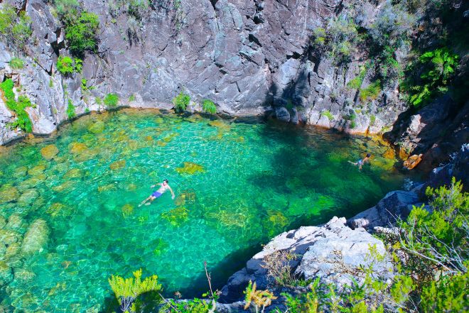
image: Gerês. Foto: partiupelomundo.com

Comment (0)